HH140 Skyrider Route
140km Skyrider Route (HH140)
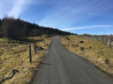
The HH140 is a significant extension to the Haydon Hundred family of rides, adding 40km and taking the total climb for the day up to over 2800m. This area is known as the ‘Roof of England’ for good reason. The 6 highest roads in the country are all here and we use 5 of them. The roads are wonderfully smooth and traffic free and the climbs are not as hard as you might expect.
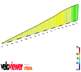
The map below shows the extra loop of the Skyrider - see Challenge and Classic routes for the other sections.
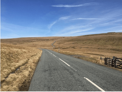
This route is very high and exposed. In bad weather it can become hazardous very quickly and riders are advised to be well prepared for changing conditions. The organisers reserve the right to cancel this section if the weather is deemed too poor for the ride to proceed safely.

The SKYRIDER is all about the hills - in fact there’s nothing else, 4 climbs and 4 descents and that’s it. So here goes......

At the Nenthead Feed Station you go right (the Classic goes straight on) and after 100 yds through the pretty village of Overwater you turn left and are straight into the steepest part of the climb. At 1.5km it is not too long but it does hit 20% almost immediately before easing back for the rest of the climb. If you make it up here you can relax. That’s the steepest part of the Skyrider done. After a lovely descent you turn onto the bottom of Yad Moss. But be careful going down, there's a sharp bend and the main road junction at the bottom comes up awfully fast!

This is a 4.5km climb but it is very gentle all the way and gives you a chance to recover before the challenges to come. Once you’re over the top you are treated to an 11km descent. The views are spectacular both up and down as you travel along Teesdale and move from Cumbria to County Durham.

Langdon Fell is 4km long but with a dip in the middle you do get a bit of a rest. The gradients are moderate all the way up allowing you to enjoy the beautifully wild scenery here on the Roof of England. Over the top there is a fast decent on super smooth new tarmac but there is a deceptive bend and then a cattle grid part way down so be careful. And don’t miss the left turn before the bottom - if you do I’d advise just turning left on the main road and rejoining the route at Ireshopeburn. Only a masochist would ride back up!

This climb is 5.5km from the steep little kick up after the bridge at Cornriggs, but the first 4.5 is just there to soften you up for the finale!
Kilhope Cross is not super steep, with just a short section above 10%, but you are pretty tired when you get there and it always seems like the hardest part of the route, particularly with the prevailing westerly wind. At the top there is an extra feed-station just for our intrepid Skyriders.
There is a Strava King of the Mountains segment based on the Skyrider route from Nenthead to Killhope Cross.
After the feed-station you tear down a 15% gradient for about 1km before turning right and rejoining the HH100 Classic route for the easy ascent of:
Black Hill; 609m, 1998ft; 3rd highest road in England
If you would like to know more about Britain’s highest Cols, tracks and dead ends click the following link for more information.
The Bridge Library, Church Street, Haydon Bridge, NE47 6JQ.